Valley of Desolation Camdeboo National Park
Graaff-Reinet – Great Karoo – South Africa
Is Camdeboo National Park Worth a visit?
Stormy clouds are looming. Yet the land is gasping. Acacias crackle in the breeze, surrounded by long white thorns sticking out in all directions, like swords fending off thieves. To my mind there is nothing edible to loot from the branches. Parched grass quivers in the slight breeze. Could a living creature survive? At first glance it seems unlikely.
The Karoo is renowned for being arid and Camdeboo is equally unforgiving. The merciless drought of the last six years and the worst in 100 years has left this region desolate.
And yet there is life in this national park.

Sunset at Camdeboo National Park
Plains of Camdeboo in the Karoo Heartland
The first time I had heard about Camdeboo or more specifically The Plains of Camdeboo was through a prescribed book written by Eve Palmer. We profusely objected to reading it in high school but secretly I was fascinated by it. The book has become a classic in South African literature and was first published in 1966.
Eve and generations of her family lived on a Karoo farm called Cranemere for decades where they battled to survive. Located on the Plains of Camdeboo, the family had to adapt to living on this demanding land.
“This home of my childhood lies towards the southern tip of Africa, on the eastern fringe of a vast plateau, the Great Karoo.
It is in the heart of the plains with mountains rising steeply to the north, and like a far blue rim to the east and west. South, as far as we can see, there is only plain. It is a wide upland world, 2,500 feet above the sea and a hundred and fifty miles from it, almost midway between Cape Town and Johannesburg, just south of Olive Schreiner’s famous Karoo farm, north and east of Pauline Smith’s Little Karoo.
”
For many years after I left school, we have driven through the town of Graaff-Reinet on numerous occasions between Johannesburg and Port Elizabeth or Plettenberg Bay. Not once did we stop overnight. For us the town of Graaff-Reinet and as a result Camdeboo Plains was more a pass through. Yet I always had a nostalgic yearning to linger and capture an inkling of Eve Palmer’s love for the land.

Graaff-Reinet
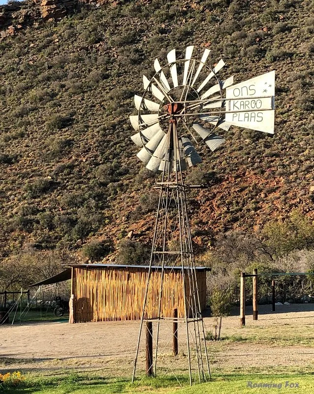
We leave Ons Karoo Plaas near Laingsburg, where we stayed for one night and drive towards the Swartberg Mountains. The route takes us through Seweweekspoort, one of the gravel roads and gateways through the mountains. Our journey takes us onto the R62 towards Oudtshoorn and De Rust. We continue on the R341 to Willowmore past Aberdeen to Graaff-Reinet. After Willowmore evidence of the drought in the Karoo leaves us depressed. Although the Karoo is a vast semi-desert area, this is truly bleak.
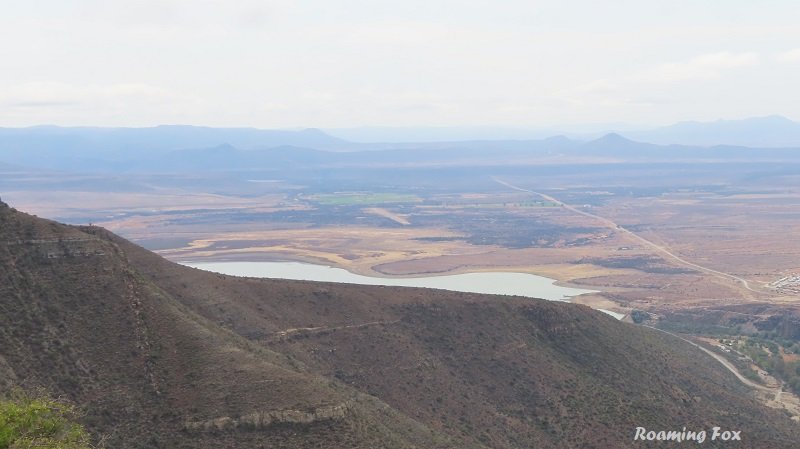
Although often rather empty, it is heart wrenching to see how dry the Nqweba Dam is at Graaff-Reinet. The sleepy but historical town is central to Camdeboo. It is almost entirely circled by a reserve, the Camdeboo National Park. It is also the fourth oldest town in South Africa and originated in 1786. Apparently the town holds more than 220 national monuments.
The Sundays River sweeps around the town of Graaff-Reinet in the shape of a horseshoe. Spandaukop stands tall above the town. The immense plains of Camdeboo lie between the Sneeuberge in the north to the Baviaans Mountains in the south.
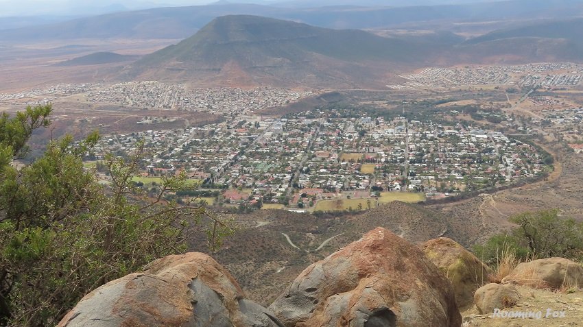
The town of Graaff-Reinet

Plains of Camdeboo and Valley of Desolation
Camdeboo National Park
Accommodation
The size of this national park is approximately 194 km². Accommodation consists of a Lakeview tented camp with 4 rustic tents and Nqweba camp with 15 campsites. All have power. Other accommodation can be found in and outside the town of Graaff-Reinet at guest houses and lodges.

What is the meaning of Camdeboo?
The name Camdeboo originates from the Khoikhoi and apparently means green hollow or heights. Difficult to imagine when one sees the area so dry. In a good year, rainfall can reach to 300 millimetres. In a bad year this area of the Karoo can be lucky to get 75 millimetres.
Camdeboo Campsite
Upon arrival at our campsite within the Camdeboo National Park where we will stay for two nights, we have our first wildlife encounter. Can you guess what it is? Monkeys of course! These cheeky little creatures have a habit of appearing just about anywhere and out of nowhere.
As we park our caravan there is no sign of them. The rear door of our vehicle is open as we unpack it and put things into our caravan.
As I turn and walk back to the car I see movement inside the vehicle. A sneaky and cheeky little devil has taken the gap and has slipped into our vehicle. Not wanting to block his exit I chase him from the front of the car and he makes a dash for it. Not before he snatches a snack that we have left lying on our cool bag inside the car. They are so quick! It is rather disconcerting to be on guard to such an extent when one unpacks or when one is camping.
The campsite overlooks the Nqweba Dam – or rather a large expanse of dry edge. There is a lookout deck and from the top we can see more of a pond than a dam in the distance. We watch the sunset through the moody clouds. They’re a tease, because they produce nothing.

Lookout deck at Camdeboo National Park

Sunset over Nqweba Dam at Camdeboo National Park
Dots close to the edge of the water turn out to be some straggly wildebeest. In front of us a hare nips into his armour of thorny bush in case there is a predator on the prowl. There is a little hope for survival.
Our evening is peaceful under the cloud covered stars. We even hear lions in the distance although we think they are from the adjacent property.
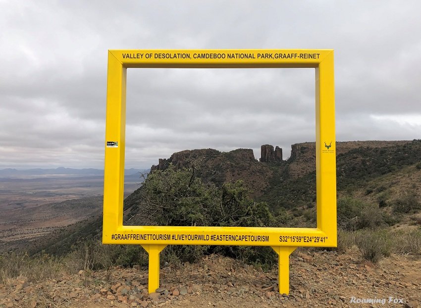
Valley of Desolation
The following morning we want to drive to the Valley of Desolation, 14 kilometres outside the town. Often called the Cathedral of the Mountains, the Valley of Desolation is situated in the game reserve although the wildlife is sparse around the dam. We count ourselves lucky to see a herd of wildebeest and a few springbuck.

Springbuck
As we enter the gate at the foothills of the mountain the aspects change. The vegetation adjusts albeit slowly. Gemsbok stand amidst some succulents. I wonder if they are keen on the orange flowers. Here the flora seems to have absorbed any moisture that came their way on previous occasions. The clouds build up and hang around the higher terrain. Rain is still elusive, but the misty conditions must provide some sustenance.

Gemsbok

Oryx or Gemsbok
The Valley of Desolation is a renowned tourist site. One can understand why when you see the magnificent narrow piled columns of dolerite towering above the Camdeboo plains. The columns date back to the Jurassic Period and are the product of volcanic and erosive forces of nature.
The viewpoints offer magnificent views over the plains as well as the town of Graaff-Reinet. Unfortunately it is hazy and cloudy so our view is marred.
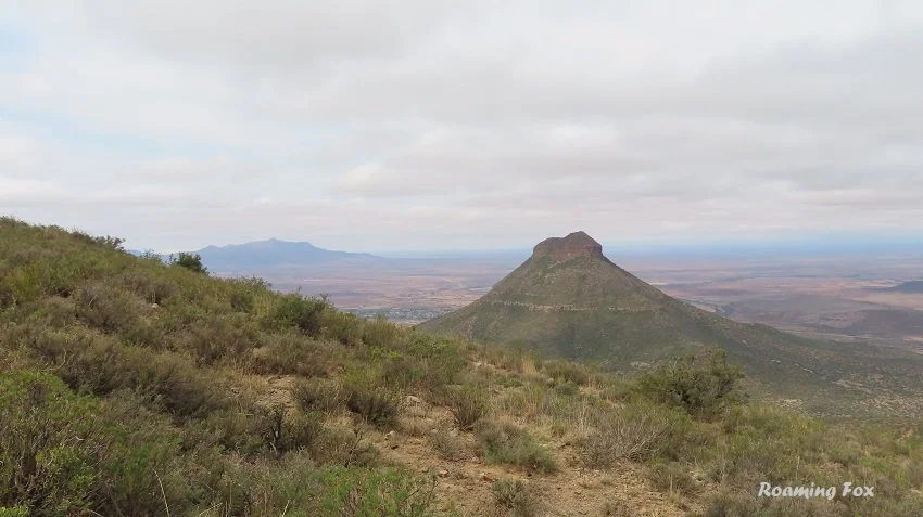
Spandaukop

Valley of Desolation

Spandaukop in the background
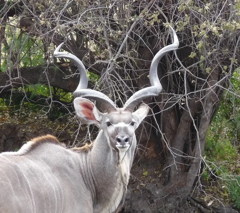
Unexpectedly one is astounded by the diversity of fauna and flora. Over 220 recorded species of birdlife will delight any birdwatcher, including the majestic Black Eagle and the heaviest flying bird in the world, the Kori Bustard. There are also 336 recorded plants and 43 recorded mammals one of which is the Cape Mountain Zebra. Most of them remain elusive to us.

Black headed Heron

Booted Eagle - pale morph
There are lovely picnic sites offering beautiful scenery and we stop for a short lunch. There are also a few hiking trails. We admire the view at the toposcope near the top of the mountain and spend some time looking over Graaff-Reinet and the surrounding valley. Time to move on to the viewpoint at Valley of Desolation.
Nqweba Dam

Toposcope
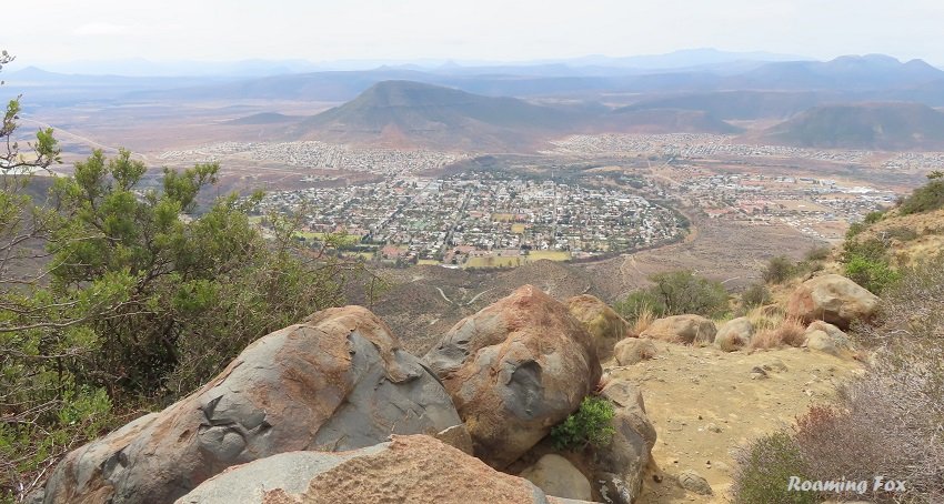
Graaff-Reinet

Dolerite pillars

We stand in awe of the rock formations and the view behind them. Here is where I can connect with Eve Palmer. Surely this is the heart of the Karoo?
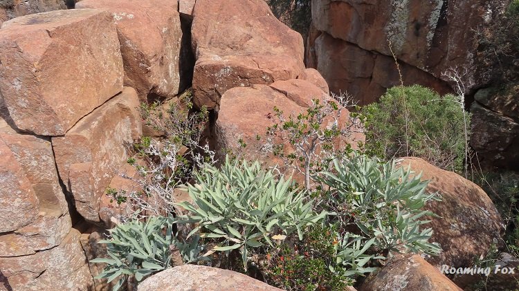
We walk part of the Craglizard Trail, a loop of 1.9 kilometres. The full trail should take 1 hour. There are overnight hikes as well.

A small section of the Craglizard trail
In 1939 the Valley of Desolation was declared a National Monument. It is of significant geological and scenic value.


Important Information about Camdeboo National Park:
As it is all national parks, you will need to pay a conservation fee upon entry. If you have a paid-up WILD Card you need to present it for free entry.
The gate to reception, Nqweba Campsite and Lakeview Tented Camp is off the N9, four kilometres outside Graaff-Reinet on the way to Middleburg.
The gate to the Valley of Desolation and the game viewing area is 5 kilometres outside Graaff-Reinet on the R63 to Murraysburg.
Take note of the gate times when planning your trip and activities.


Did you know:
Camdeboo National Park is a relatively new National Park when it was proclaimed one in 2005 by SANParks.
The Camdeboo National Park includes the Valley of Desolation, also known as the Cathedral of the mountains and its rocky piles of dolerite sentries on the plains of the Great Karoo.
Why is it called the Valley of Desolation? No explanation is required if one sees the valley at its driest period. Tough pioneers struggled to survive but many of them succeeded through courage, hard work, commitment and faith.
The Valley of Desolation is part of South African national school curriculum and the park offers educational guided tours for school groups.
In the 1600’s the Inqua tribe occupied the area. Their vast herds of cattle and flat-tailed sheep grazed on the apron veld from the Camdeboo River near Aberdeen and across the Sundays River to Agter-Bruintjieshoogte near Somerset East.
In later years around 1770, white farmers made the Camdeboo Plains and Sneeuberg their home. They introduced other livestock such as angora goats and merino sheep.
Did you know the Nqweba Dam is used for recreation and watersport? When it is full it can cover a total of 1000 hectares. It is popular among canoeists and windsurfers. It is also popular for boating and angling where a variety of fish can be caught.

Unusual thorny plant
Where is Camdeboo National Park?
Where is Valley of Desolation?
Footnote:
Towards the end of 2021 the Karoo had some summer rains that at least partially broke the drought. Apparently the dam has filled up somewhat and the landscape is much greener after some relief from the prolonged drought. Long may it last.
On Pinterest? Pin for later.

Like this Pin?
Click on Pinterest button and pin for later
Find me on Social Media


About the author
ALMA VAN AS | ROAMING FOX
Alma is a South African travel blogger and writer. She hopes to inspire you with facts and fables about her adventures, road trips and international travel.
Booking Accommodation
If this article inspires you to travel it would be greatly appreciated if you book your accommodation via the links on this page. Alternatively take a look at my shop page. When you book it will earn us a small commission at no extra cost to you. This will also assist in keeping the Roaming Fox website running.
As always, I appreciate your support. Thanks! – Alma aka Roaming Fox.
We turned off the R61 outside Cradock onto a gravel road and drove about 2 kilometres to Mountain Zebra National Park gate. Or rather we rattled and shuddered. Our teeth chattered, but not from cold. I might even have bit my tongue – literally.