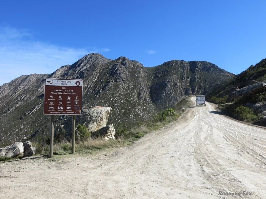
Scenic Swartberg Pass
Swartberg Mountains – Klein Karoo – Western Cape - South Africa
History, adventure and breathtaking scenery on the Swartberg Mountain Pass
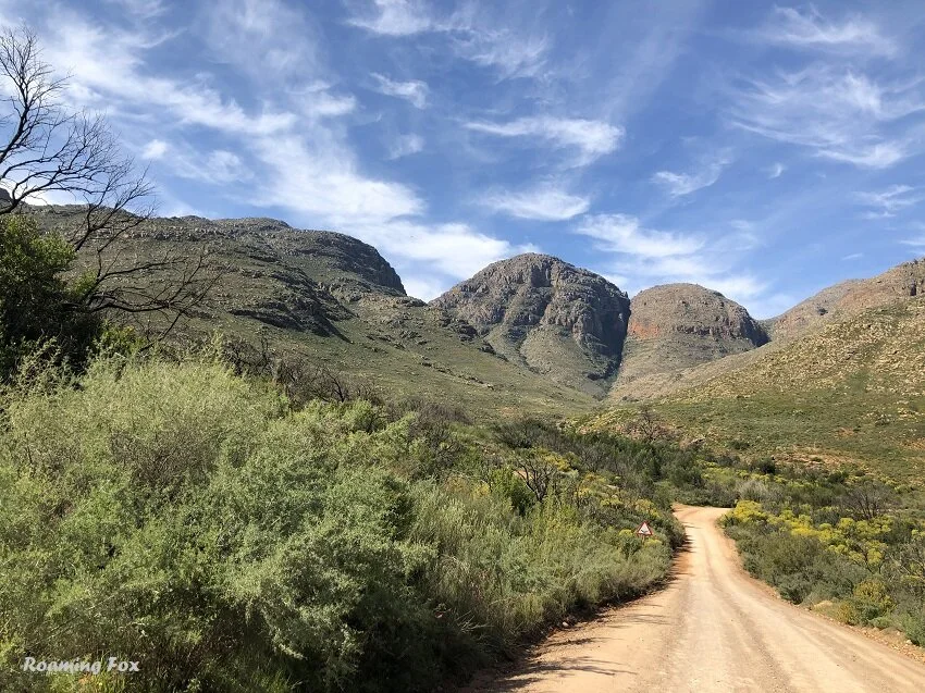
Ascending from the south
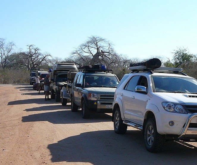
As the gravel crunches under our wheels there is an air of anticipation. We are driving one of the most iconic passes of South Africa. We’ve been told if you haven’t driven over the Swartberg Pass you have missed out on an adventure and beautiful scenery. What makes the Swartberg Pass so special? After all, it is just a gravel road, generally in good condition and most sedans can easily drive on it.

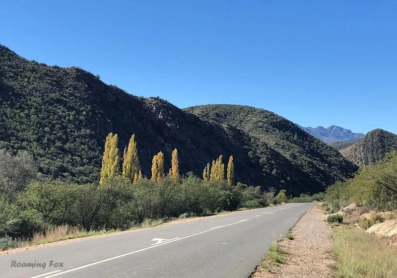
The pass from the southern side, near Oudtshoorn
The challenge lies in various areas. After rain or snow the road can be deceitfully slippery. In misty conditions it can also be daunting. The narrow sections are only suitable for one way traffic with numerous switchbacks, hairpin bends and blind corners. One has to stay alert for approaching vehicles especially on the narrow sections. Stopping in undesignated areas can be quite treacherous. Although there are dry stone walls in places I doubt they would withstand another vehicle bulldozing yours, unintentionally, over the edge.

The day is clear with very few clouds in the sky. Our ascent on the gravel from the southern side is a breeze. Let me rephrase that. The pass is in excellent condition and a pleasure to drive but the wind is howling. The road is wide though and thankfully we are not in a lightweight vehicle that will disappear with a huff and a puff over the precipice. We stop at Skelmdraai to admire the scenery in the Cango Valley below and we HAVE to take a few pics.

We hold tightly on to the doors as we step out the car. After all, we’d hate to drive away with two gaping holes and a howling gale blowing over us. But it is worth stopping. Did I mention how great those views are?
Not only do we have to hold onto the doors, we clutch onto our cell phones and cameras for dear life or they may go hurtling down the mountain. As I snap away I wonder how blurry my photos will be.

Not an animal in sight, possibly because of the windy conditions but apparently you can sometimes see klipspringer prancing from rock to rock or rhebuck and grysbok darting between the fynbos. No doubt there would be baboons too, as we’ve heard them constantly at our campsite at the base of the mountains.

Why is that corner called Skelmdraai? Apparently if you are coming from the other direction, the road seems to disappear over the edge until you get close to the bend and see there is a very sharp turn. Hence the advice to always stick to the recommended speed limit of 40-60 kph.

We continue up the steep gradient to the highest point of the road, at 1532 m. If we thought it was windy at Skelmdraai, here we virtually glue our feet to the ground. The poor bikers that have stopped to admire the view are holding on to their trusty steeds for dear life so they don’t fall over. The wind is icy too.

Sad to see the sign covered in stickers
I take note of the stickers that have defaced the sign. So sad. Why do people have to do that? Mountain Passes of South Africa does a sterling job of removing these defacing spectacles but it should not even be necessary for them to do it. It is also a time consuming task.
We etch those views to reflect on in the future. In case our memories fail, we take a few pics with our cameras and hop back into the car to continue with our descent.

The road on the pass going north towards Prince Albert
Did you know there are three routes through the Swartberg Mountains?
Discover them here.

The gorge on the northern side of Swartberg Pass
Northern Descent
The scenery changes on the northern side. Still spectacular, in fact more so, but so different. A rugged landscape imprinted by the movement of time and sketched by the challenge of weather. We would love to stay in one spot to admire the views but we are drawn to move on to see more.

Here the road is more hazardous, with narrower sections but still in good condition. We reach a flattish area with a turnoff to the left to Gamkaskloof, otherwise known as ‘The Hell’.

Heading to Gamkaskloof - The Hell
We take the turn to explore a bit but don’t want to go all the way down into the valley as the road is bumpy and rocky and it would take too long because there is no other way out when we get to the bottom of the valley. We would have to turn around and go back the way we came. It would take us an extra four hours or more to do this section and we still wanted to see the rest of the Swartberg Pass.

48 km of this with narrow and steep sections to The Hell
Eventually we turn around after driving for about twenty minutes.
We continue down the pass in the direction of Prince Albert and are satisfied with our decision. The scenery is just astounding. The hairpin bends and unexpected switchbacks are exhilarating and beautiful at the same time. The road is indeed narrow, but fortunately not much approaching traffic so we don’t have to take evasive action.

The precipitous zigzags lead you into beautiful vistas that must set geologists hearts racing when they see the rock formations from all angles. I know it did mine and I just admire different rock formations.
When we pass a section a memory niggles Paul. He remembers that he and his family drove in their sedan up the pass. They then camped somewhere next to the pass in his childhood. They even drove down to The Hell in their sedan. There is an open area that looks familiar except the trees he remembers are no longer there.

A little further down the pass we stop at Blikstasie ruins and realise how steeped in history the pass is. This used to be a confinement building at night for the convicts that helped build the road and pack the stone walls.

Ruins of Blikstasie jail
Once we reach the bottom of the pass it is not with a sense of relief that we leave it behind but rather of disappointment that we have reached its end.

We turn onto the tar and head for Prince Albert where we have lunch at Lah-di-dah, a delightful coffee shop. I was under the misconception we would return via the tar road and do the circular route back to our campsite at De Hoek Mountain Resort, but then Paul said it would be quicker over the pass. There was no hesitation on my part when I agreed. This would be a great opportunity to see the pass from a different angle.

Heading from the north to the south at the start of the pass
History and facts about the Swartberg Pass and Mountain Range
The rugged and beautiful Swartberg Mountain range formed a barrier which was considerably impassable between the Little (Klein) Karoo and the Great (Groot) Karoo.
Initially there were only two roads between the port of Mossel Bay and inland to the Karoo. These routes were Meiringspoort and Sevenweekspoort (Seweweekspoort). Often these roads were closed due to rockfalls and flood damage after heavy rains due to their low elevations of between 780 and 820 metres.
The Swartberg Pass was the last of seventeen passes built in the Cape Province by the phenomenal engineer Thomas Charles Bain. He must have inherited his skills from his father Andrew Geddes Bain who was an equally successful engineer that built amongst other passes the Bain's Kloof Pass.
Before the Swartberg Pass was built there was a footpath over the mountain, apparently still in existence today, between Prince Albert and Oudtshoorn and could only be negotiated on foot or on horseback. Thomas Bain tried four different routes through the steep gradients before he found a viable path for the road.
Over 200 convicts helped build the road and walls laboriously as they slung pickaxes and scooped spades of gravel and stone. Construction was made possible through the impenetrable rocks by using gunpowder or splitting boulders by heating them with fire, then cooling them with cold water. Thereafter sledgehammers were used to break them into smaller rocks.

The retaining walls were built by a dry wall method and most of them are still in place 130 years later.
After years of arduous labour, unfavourable weather conditions and some disputes, the pass was opened officially on the 10 January 1888. To use the pass you had to pay a toll fee of 4 pennies per wheel and 1 penny per animal.
The pass is about 24 kilometres long (excluding the section going down to The Hell) and takes at least an hour if you do not stop to take in the view or admire the fynbos.
Don’t be surprised to hear hooting on the Swartberg Pass. Often approaching vehicles do this to warn that they are coming round a blind corner.
The Swartberg Nature Reserve is within the Swartberg Mountains where you can hike, picnic, birdwatch, drive a 4x4 route or just enjoy nature.

The Gamkaskloof road to The Hell was opened in 1962. Previously a small farming community lived there in isolation with only a steep donkey trail or footpath as access. The road consists of approximately 9 small passes and at the end a large one called Elands Pass. This route is only advisable with a high clearance vehicle or preferably a 4x4 and is very narrow in places. If you want to tackle this adventure either allow an entire day for it or book accommodation in advance at The Hell with Cape Nature or Fontein Guest Farm.

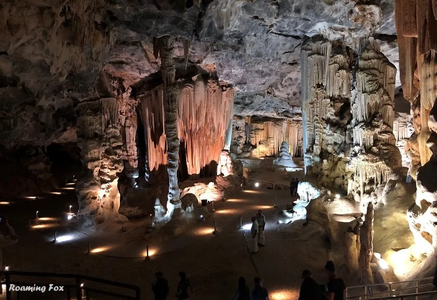
The Swartberg Mountains holds another phenomenon. Not only is it worth negotiating the pass as well as its beautiful fauna and flora, there are underground natural wonders to explore at the Cango Caves like we did.
A short clip of us driving parts of the Swartberg Pass
Hot tips:
The pass can get busy so be sure to stick to the left-hand side of the road as much as possible as other vehicles often drift onto the wrong side of the road because they are distracted by the scenery.
You don’t need a 4x4 for the Swartberg Pass unless you want to take the route down to Gamkaskloof.
No heavy vehicles are allowed and yet often trucks get stuck. Their reasoning is that they were following the route on the GPS. That may be true to an extent but they are also disobeying the signs at the bottom of the pass. This results in rescue vehicles needing to come to their assistance, at the least.
You are not allowed to tow a caravan over the pass. Some may dispute that you can tow an off-road trailer or caravan on the road which I would agree with – in principle it is possible – but advisable? No, for various reasons, especially when you come face to face with another vehicle on a narrow section. Who would be the one that needs to reverse and if so, who can reverse well with a trailer or caravan behind them on narrow sections or around sharp, blind corners?
The right protocol, whether it be written or unwritten on any off road or narrow pass is to give way to the ascending vehicle, so if you are on your way down it is your responsibility to stop.
If you want to admire the scenery, park in a suitable area such as at the view sites or where it is wide enough for another vehicle to pass, so as not to block the road. It is advisable to make sure your hand brake is on securely when on a slope as there have been some incidents where people have not applied them properly or even forgotten to. Nothing worse than finding your vehicle hurtling down the cliff. Unless you are in it.
Where is the Swartberg Mountain Pass?
The pass is on the R328 between Prince Albert and Oudtshoorn.
Map

The Swartberg Pass was part of our road trip through parts of the Eastern Cape, the Western Cape and the Karoo. If you are interested, below are some links to the related articles that I have written.
Scenic Road Trip Itinerary and Route South Africa
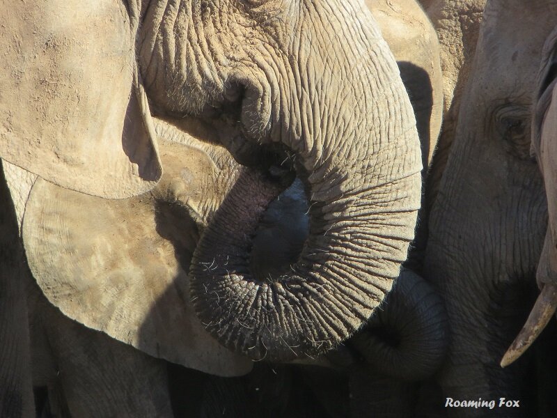
Facts about Addo Elephant National Park
Storms River Village Tsitsikamma
Storms River Mouth Rest Camp Garden Route Tsitsikamma
Pin to read later

Click on Pinterest button to pin

Pin by clicking Pinterest button
Find me on Social Media


ABOUT THE AUTHOR
ALMA VAN AS | ROAMING FOX
Alma is a South African travel blogger and writer. She hopes to inspire you with facts and fables about her adventures, road trips and international travel.
Booking Accommodation
If this article inspires you to travel it would be greatly appreciated if you book your accommodation via the links on this page. Alternatively take a look at my shop page. When you book it will earn us a small commission at no extra cost to you. This will also assist in keeping the Roaming Fox website running.
As always, I appreciate your support. Thanks! – Alma aka Roaming Fox.
The Best Way to see a country? Take a road trip! Have you ever had that feeling when you hit the open road on your road trip? Freedom. Anticipation. Exhilaration.